 SketchMap Atlas
Routes › St Petersburg: from Nevsky to the Neva
Martynov · Sadovnikov · Vorobyov
The Fontanka, Kazan Cathedral, Palace Square and the sphinx quay through nineteenth-century eyes

Tap a seal to see the sketch, or press “Walk the route”.
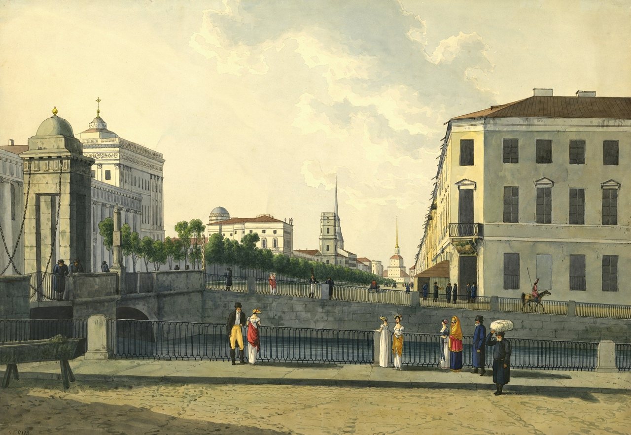
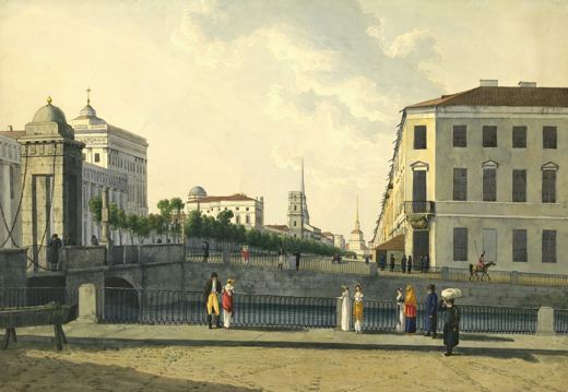
The straight perspective of the avenue towards the Admiralty spire from Anichkov Bridge.
Public domain · Source · More about this sketch
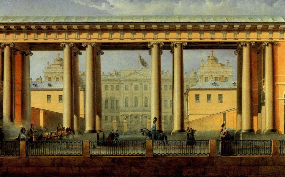
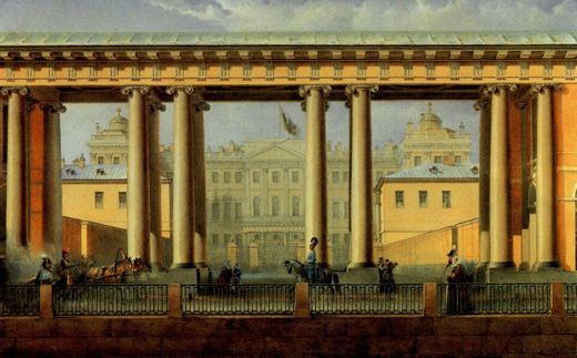
Boats on the Fontanka and the old Cabinet colonnade by Anichkov Bridge: a watercolour of 1838.
Public domain · Source · More about this sketch
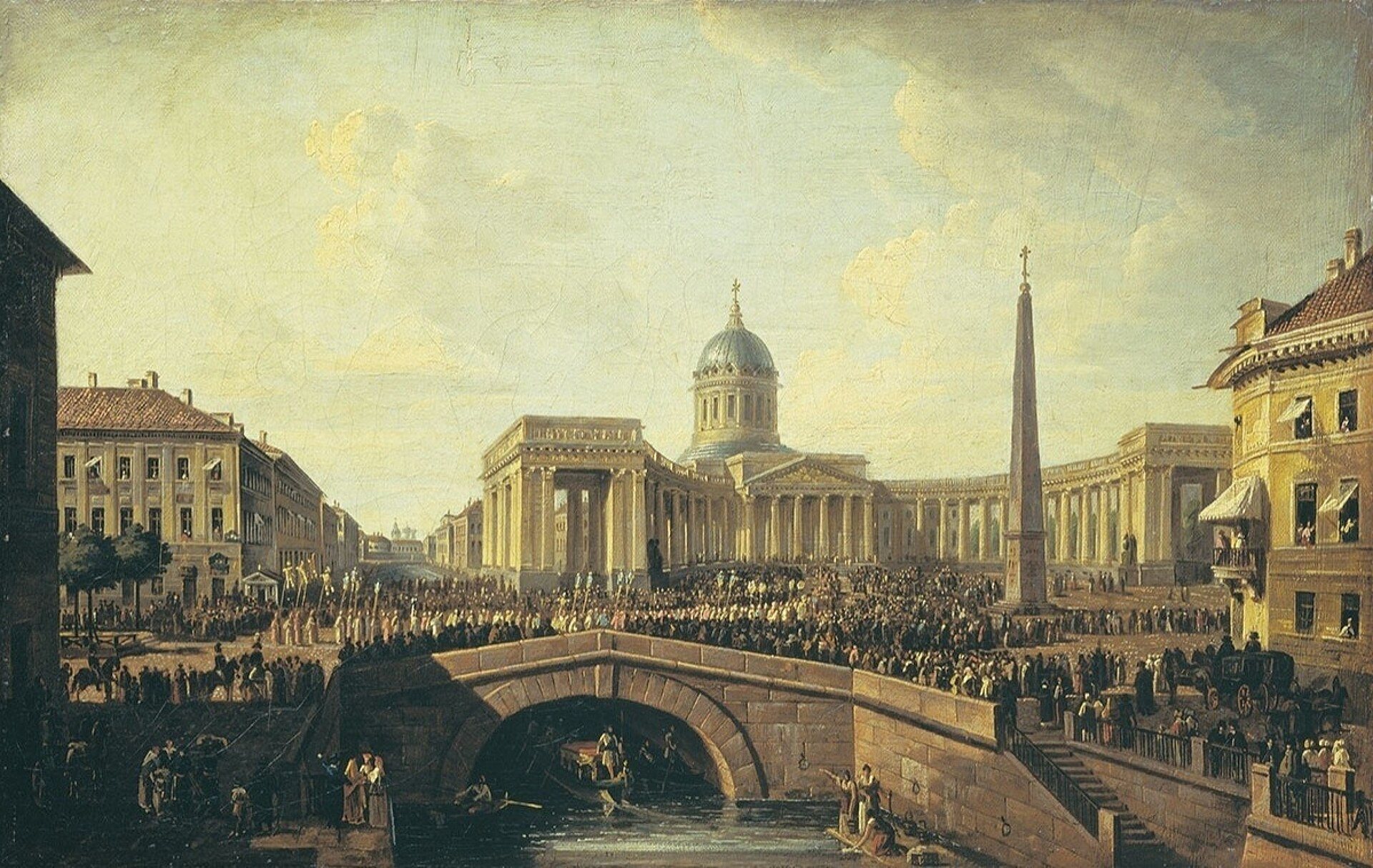
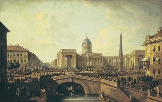
Voronikhin’s cathedral and colonnade seen from the canal during completion: a watercolour of 1810.
Public domain · Source · More about this sketch
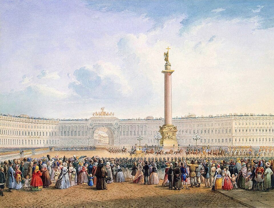
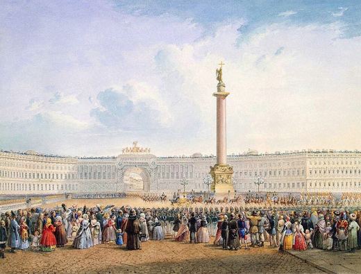
The Alexander Column, Winter Palace and General Staff Arch in Sadovnikov’s clear watercolour.
Public domain · Source · More about this sketch
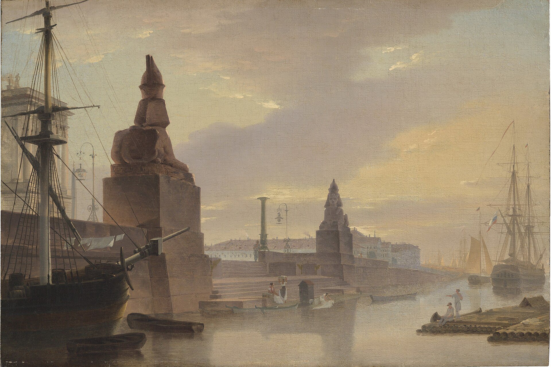
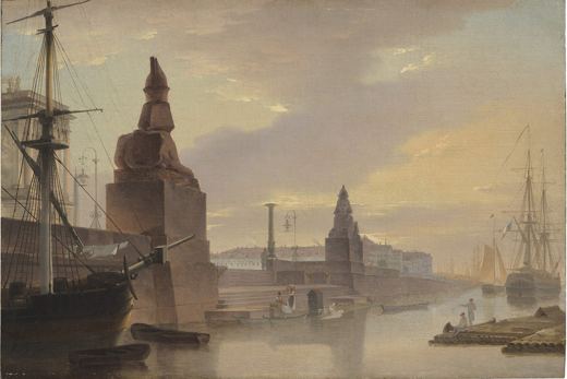
The Theban sphinxes on Universitetskaya Embankment soon after their installation by the Academy.
Public domain · Source · More about this sketch
Pick one of the stops and sketch it your way. Then pin your drawing on the map next to the old ones, with its own date and place.
Free to start · Android and web
| Stop | Work | Artist | Date | Coordinates |
|---|---|---|---|---|
| 1 | Nevsky Prospekt from the Fontanka | Andrey Martynov | c. 1809 | 59.9332, 30.3431 |
| 2 | Colonnade of Anichkov Palace on the Fontanka | Vasily Sadovnikov | 1838 | 59.9329, 30.3411 |
| 3 | View of Kazan Cathedral | Maxim Vorobyov | 1810 | 59.9343, 30.3245 |
| 4 | Palace Square | Vasily Sadovnikov | 1840s | 59.9390, 30.3158 |
| 5 | Quay with Sphinxes on the Neva | Maxim Vorobyov | 1835 | 59.9369, 30.2992 |
Artists on this route: Andrey Martynov, Vasily Sadovnikov, Maxim Vorobyov.
It starts at “Nevsky Prospekt from the Fontanka” and ends at “Quay with Sphinxes on the Neva”: 5 stops, about 2.7 km apart measured in straight lines. Streets and paths wind, so the real walk is longer, and you will want time to sit and draw at each stop.
The sketches are by Andrey Martynov, Vasily Sadovnikov and Maxim Vorobyov, made in the 19th century. Each one is shown on the map at the place where it was drawn, with its source and licence.
Yes. SketchMap Atlas is a free app for Android and the web where every sketch is pinned to the place and date it was made. Open this route in SketchMap Atlas to see all 5 stops on a map, then add your own sketch next to them.
Yes. In SketchMap Atlas you pick two to ten sketches on the map, put them in order, name the route and share it as a link.
No. You can open any SketchMap Atlas route and look at every sketch without signing up. You need an account only to publish your own work.
Updated 28 October 2026